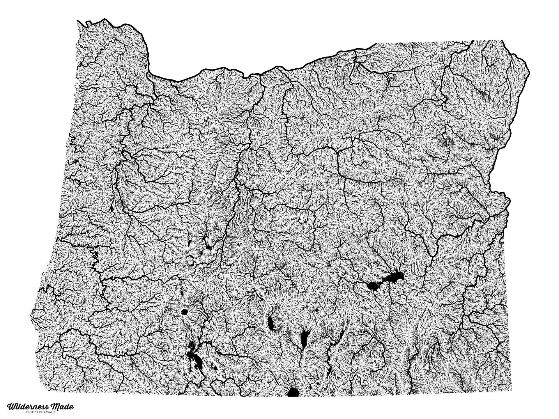
Highly Detailed River Map of Oregon - Found on https://www.reddit.com/r/oregon https://www.reddit.com/user/jsvd87 said "I made this map using elevation data from Nasa's Shuttle Radar Topography mission. We're selling prints on our site with 100% of the profit donated to the Wild Steelhead Coalition." Pretty cool. If you look close you can see Floras Creek! Read more about Highly Detailed River Map of Oregon - admin's blog